
Best Apps for Editing Drone Photos for Real Estate
Looking for the best apps to edit drone photos for real estate? Explore popular tools for improving aerial image quality, enhancing colours, and adding nearby Points of Interest to property photos.
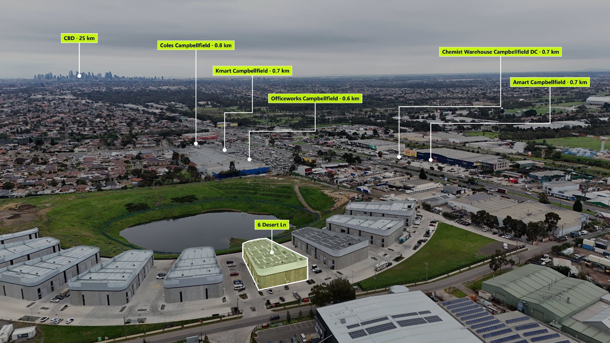
Drone photography is one of the most effective ways to showcase a property. Aerial images allow buyers to see the home, land size, surrounding streets, and nearby lifestyle features.
However, capturing the photo is only the first step. Editing your drone images properly can make them look more professional and help your real estate listings stand out.
Here are some of the best apps and tools used for editing drone photos.
Adobe Lightroom – Best for Professional Photo Editing
Adobe Lightroom is one of the most popular editing tools used by photographers.
Lightroom is great for improving drone photos by adjusting:
- Brightness
- Colours
- Contrast
- Shadows
- Highlights
- Sharpness
For real estate photography, Lightroom helps create clean and consistent images across multiple listings.
Many photographers also use presets to quickly apply the same style to every property.
Photoshop – Best for Advanced Drone Photo Editing
Adobe Photoshop is a powerful tool for photographers who need more control.
Photoshop can be used for:
- Removing unwanted objects
- Enhancing skies
- Creating marketing graphics
- Adding custom designs
- Fixing small image issues
It is a great choice for detailed editing, but it can take longer to learn compared to simpler tools.
Snapseed – Best Free Mobile Editing App
Snapseed is a free photo editing app that works well for quick drone photo improvements.
It allows users to adjust:
- Exposure
- Colours
- Details
- Perspective
- Image quality
Snapseed is useful for photographers who want to edit drone images quickly from a phone or tablet.
Canva – Best for Real Estate Marketing Designs
Canva is popular among real estate agents and marketers who want to create simple designs.
Canva can help create:
- Social media posts
- Property brochures
- Promotional images
- Listing graphics
It is easy to use, making it a good option for beginners.
Adding Points of Interest to Drone Photos
Editing the image is only part of creating professional real estate drone photography.
Buyers also want to understand the surrounding area.
Adding Points of Interest (POIs) can show:
- Schools
- Parks
- Shopping centres
- Train stations
- Cafés
- Beaches
- Local attractions
These details help buyers understand what makes the location valuable.
AerialPin – Add Nearby Locations to Drone Photos
AerialPin helps real estate photographers add nearby Points of Interest to drone images.
Instead of manually searching maps and creating every location marker, AerialPin helps simplify the process.
With AerialPin, photographers can:
- Find nearby locations
- Add professional POI markers
- Create informative aerial property images
- Showcase the surrounding suburb
- Add extra value to real estate listings
What Software Should Real Estate Photographers Use?
The best workflow often combines different tools:
For capturing photos:
- DJI Fly
- Drone camera settings
- HDR photography
For editing images:
- Lightroom
- Photoshop
- Snapseed
For showing the location:
- AerialPin
Using the right combination of tools helps create drone photos that are not only visually impressive but also useful for potential buyers.
Create Better Real Estate Drone Images
Great drone photography is about more than taking a photo from the sky. The best images combine professional editing with useful information about the surrounding area.
By improving image quality and adding nearby Points of Interest, photographers can create property marketing images that help buyers understand both the home and the lifestyle it offers.