
Best Free Tool to Add Points of Interest to Drone Photos
Find the best free tools to add Points of Interest to drone photos. Learn how to add schools, parks, transport and locations to real estate aerial images.
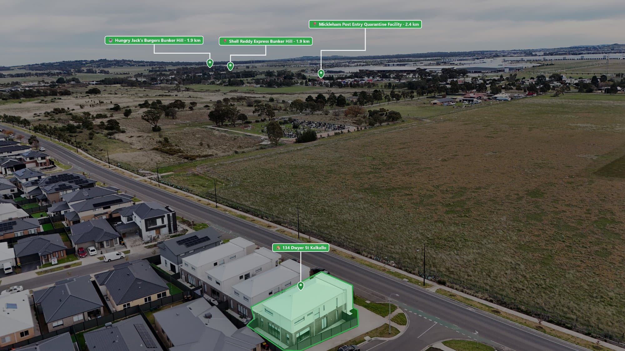
Drone photos are a great way to showcase a property, but adding Points of Interest (POIs) can make them much more useful for buyers.
Aerial images with nearby schools, parks, shopping centres, transport, and local attractions help buyers understand the location and lifestyle around a property.
If you are looking for a free tool to add Points of Interest to drone photos, there are several options available depending on how much time and control you need.
What Are Points of Interest on Drone Photos?
Points of Interest are labels added to aerial images to show important nearby locations.
Examples include:
- Schools
- Parks
- Shopping centres
- Train stations
- Cafés
- Restaurants
- Beaches
- Sporting facilities
Instead of showing only the home, an annotated drone photo helps buyers see what is around the property.
1. Canva – Best Free Option for Simple Edits
Canva is one of the easiest free tools for adding text, icons, and markers to drone photos.
It is a good option for beginners who want to create simple location labels.
Advantages:
- Free plan available
- Easy drag-and-drop editing
- Lots of icons and templates
- Works in a web browser
Disadvantages:
- Locations need to be found manually
- No automatic nearby Point of Interest search
- Marker placement takes time
Canva works well for occasional drone photo edits but can become slow when creating multiple property listings.
2. Google Maps + Canva
A common free workflow is using Google Maps to find nearby locations and Canva to add them to the image.
The process is:
- Open the drone photo
- Search nearby locations on a map
- Choose important places
- Add labels manually
- Export the final image
This method costs nothing, but it requires more time and manual work.
3. Photopea – Free Photoshop Alternative
Photopea is a free online photo editor that works similarly to Photoshop.
It allows you to:
- Add text
- Create custom graphics
- Edit drone images
- Design professional layouts
However, like other free editing tools, you still need to manually find and place every Point of Interest.
The Problem With Free Tools
Free tools are useful for learning and creating occasional images, but they often require a lot of manual work.
A typical process involves:
- Searching every nearby location
- Copying names
- Creating labels
- Adjusting marker positions
- Checking accuracy
For photographers creating multiple real estate listings every week, this can take hours.
A Faster Way to Add Points of Interest
For professionals who regularly create real estate drone photos, a dedicated tool can save significant time.
AerialPin helps photographers quickly add nearby Points of Interest to aerial images.
Instead of manually searching for every location, AerialPin helps create professional annotated drone photos faster.
It is designed for:
- Real estate photographers
- Property marketers
- Real estate agents
- Builders
- Developers
Which Tool Should You Use?
If you only need to create a few images:
Canva or Photopea are good free options.
If you create professional real estate photography regularly:
A dedicated tool like AerialPin can help save time by making the process faster and more consistent.
Create Better Real Estate Drone Photos
Adding Points of Interest turns a basic aerial image into a more informative marketing tool.
Whether you use a free editing platform or a dedicated solution, showing buyers what is nearby can help properties stand out and give them a better understanding of the location.