
Best Software for Annotating Drone Photos
Comparing the best software for annotating drone photos? Discover tools for property boundaries, labels, location pins and aerial image editing.
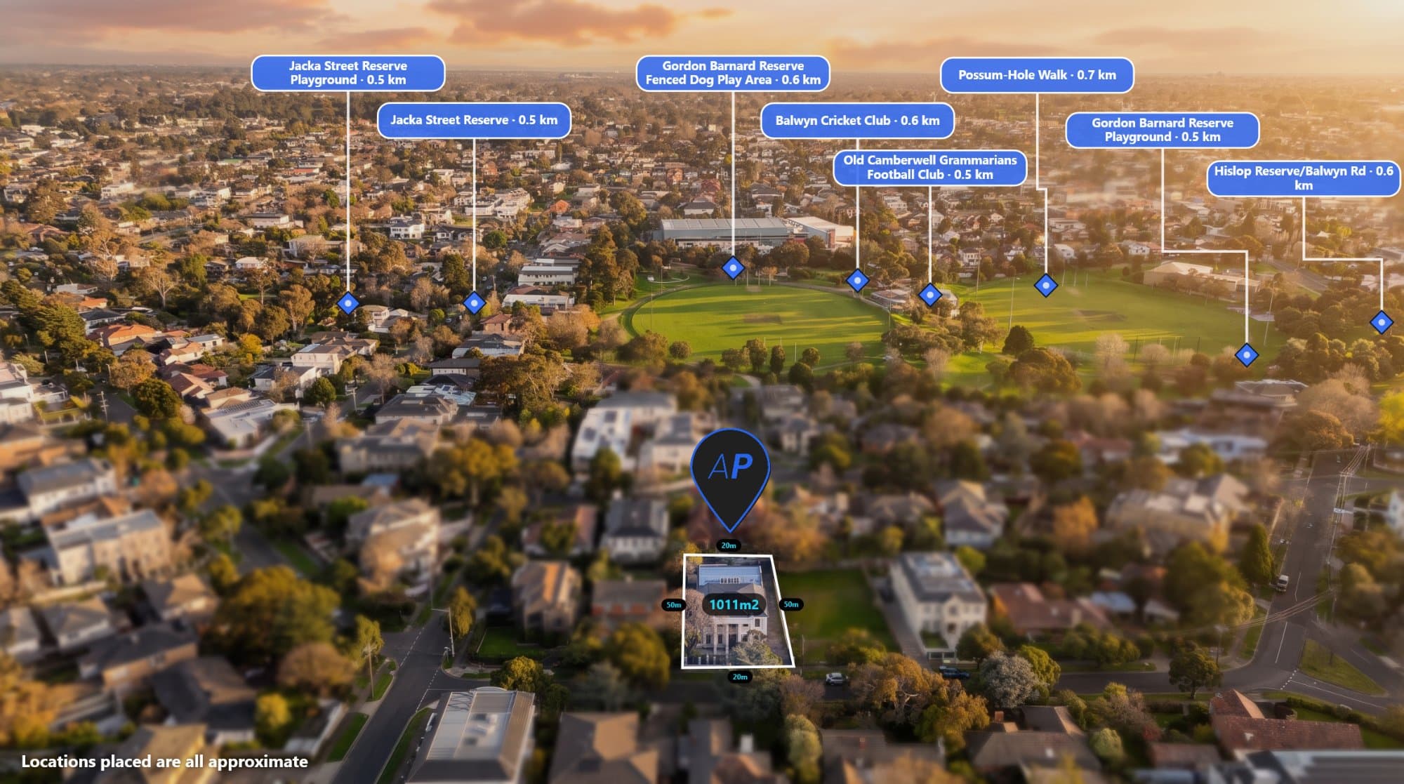
Drone photographs are used across real estate, construction, agriculture, surveying and property development.
But capturing the image is only part of the process. In many situations, the photograph needs additional information to communicate what is happening on the ground.
This is where drone photo annotation software becomes useful.
Whether you need to draw property boundaries, add location pins, identify nearby amenities or measure distances, choosing the right software can make your workflow much easier.
What should you look for in drone photo annotation software?
The best software depends on how you use your aerial images.
For real estate photographers and property marketers, useful features include:
-
Image annotation directly in a browser.
-
Property boundary outlines.
-
Customisable location pins.
-
Text labels and callouts.
-
Distance measurements.
-
GPS and EXIF metadata support.
-
Automatic location placement.
-
High-resolution image exports.
-
An easy-to-use editing interface.
For technical mapping applications, you may also need georeferencing, GIS layers, coordinate systems and measurement validation.
Popular types of software for annotating drone photos
1. Aerial photo annotation platforms
Purpose-built aerial annotation platforms focus on making drone images easier to understand and present.
AerialPin is designed for this type of workflow. It allows users to upload aerial imagery and add property boundaries, labels, location pins and distance measurements.
Its GPS-aware features can also help streamline the placement of location information on supported drone photographs.
This is particularly useful for real estate photographers, agents and land marketers who want to create polished aerial marketing images.
Website: AerialPin
2. Adobe Photoshop
Photoshop is a powerful image editing application that offers extensive control over layers, shapes, text, colour and image adjustments.
It can be used to create detailed aerial property annotations, but much of the work needs to be completed manually.
It is a good option for photographers who already use Photoshop and need extensive image editing capabilities.
Website: Adobe Photoshop
3. QGIS
QGIS is an open-source geographic information system used to view, manage and analyse spatial data.
It is useful when working with geographic datasets, map layers, coordinates and cadastral information.
However, it is designed primarily for GIS workflows rather than quick, polished real estate image annotations.
Website: QGIS
4. ArcGIS
ArcGIS provides professional mapping and geographic information system capabilities.
It is suitable for organisations that need to manage spatial data, perform geographic analysis and create mapping products.
It may be more than a real estate photographer needs for simple aerial image annotations.
Website: ArcGIS
Which software should you choose?
The right option depends on your workflow.
| Software | Best suited for |
|---|---|
| AerialPin | Real estate aerial photo annotations |
| Photoshop | Advanced image editing and manual design |
| QGIS | Geographic data and mapping |
| ArcGIS | Professional GIS and spatial analysis |
If your main goal is to make aerial property photographs more informative, a purpose-built annotation tool can reduce the amount of manual work involved.
If you need professional GIS analysis or advanced image manipulation, a dedicated GIS or image editing application may be more suitable.
Final thoughts
Drone photo annotation doesn't need to be complicated.
The right tool should help you spend less time manually adding information and more time producing useful aerial imagery.
For real estate photographers and property marketers, AerialPin brings boundaries, location pins, labels and measurements into one online workflow.
Frequently asked questions
What is the best software for annotating drone photos?
It depends on your requirements. AerialPin is designed for real estate aerial annotations, Photoshop offers advanced image editing, and QGIS and ArcGIS are more suitable for geographic information workflows.
Can I annotate drone photos online?
Yes. Browser-based tools allow you to upload aerial photographs and add labels, boundaries, pins and measurements without installing desktop software.
Is Photoshop good for aerial photo annotation?
Yes. Photoshop offers extensive manual editing capabilities, but specialised annotation tools can make common property marketing tasks quicker.
Can drone photo software use GPS information?
Some tools can read GPS and EXIF metadata from supported photographs to help identify image locations and support location-based workflows.