
EASY Outlines for Real Estate Photography!
Learn how to create clean property outlines for real estate photography and turn ordinary aerial drone photos into professional marketing images with AerialPin.
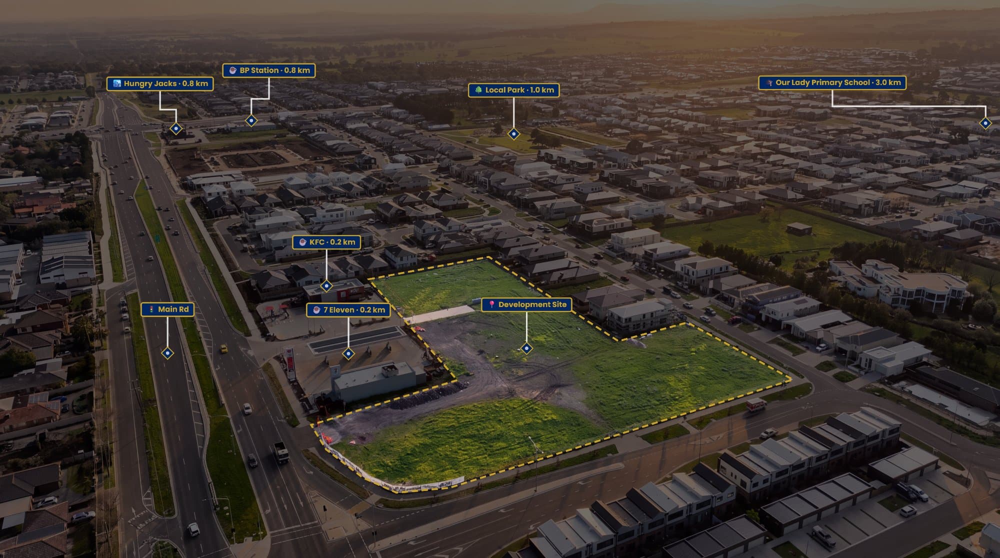
Aerial photos are already one of the most useful tools in real estate marketing. They show the home, the land, the backyard and everything surrounding the property in a single shot.
But there’s one problem.
It isn't always obvious where the property ends.
That's where a simple property outline can make a big difference.
Why Property Outlines Work
When you're looking at a drone photo from above, fences and boundaries aren't always easy to spot.
A clean outline immediately tells the viewer which section of land they're looking at.
This can be especially useful for:
- Large blocks
- Acreage
- Vacant land
- Development sites
- Corner properties
- Homes with large backyards
Instead of trying to explain the property boundaries in the listing description, you can show them directly on the photograph.
The Traditional Way
You can create an outline manually using Photoshop or another image editing program.
Open your drone photo, create a new layer and use the pen tool to trace around the property.
Then you can adjust the line thickness, colour and transparency until you're happy with the result.
There's nothing wrong with this approach, but it can take a surprising amount of time when you're doing it over and over again.
If you're photographing multiple properties every week, creating every outline manually becomes another repetitive task.
A Faster Way With AerialPin
AerialPin was created to make this type of aerial editing much easier.
Upload your drone photograph and create the property outline directly over the image.
You can adjust the appearance of the boundary, add a subtle fill and include labels to make the property immediately stand out.
You can also save your preferred styles so your aerial images have a consistent look across different listings.
Add More Than Just an Outline
Once you've created the property outline, there's no reason to stop there.
You can use the aerial image to show buyers what surrounds the property too.
Nearby parks, schools, shopping centres, transport and other important locations can all be marked directly onto the photograph.
With AerialPin AI Auto Place, compatible drone images can be analysed to help identify nearby points of interest and position them within the photograph.
That means one aerial image can show the property and its location within the surrounding area.
Don't Overdo It
The best real estate graphics aren't necessarily the ones with the most information.
Keep your outline clean and easy to see.
A simple boundary, a property label and a few useful points of interest can be enough.
You want the viewer to notice the information without losing sight of the actual property.
A Small Detail That Makes a Big Difference
A property outline might seem like a small addition to a drone photo, but it can completely change how someone understands the image.
The buyer doesn't have to guess where the property ends.
The agent has another useful marketing asset.
And the photographer can provide something more valuable than just another aerial photograph.
If you're regularly creating real estate drone images, AerialPin makes it easier to create professional property outlines and aerial annotations without building every image from scratch.
Try AerialPin and make your next aerial property photo more useful.