
How Do You Add a Property Outline to a Picture?
Learn how to add a clear property outline to an aerial or drone photo using property boundary data, image editing tools, or AerialPin for a faster real estate marketing workflow.
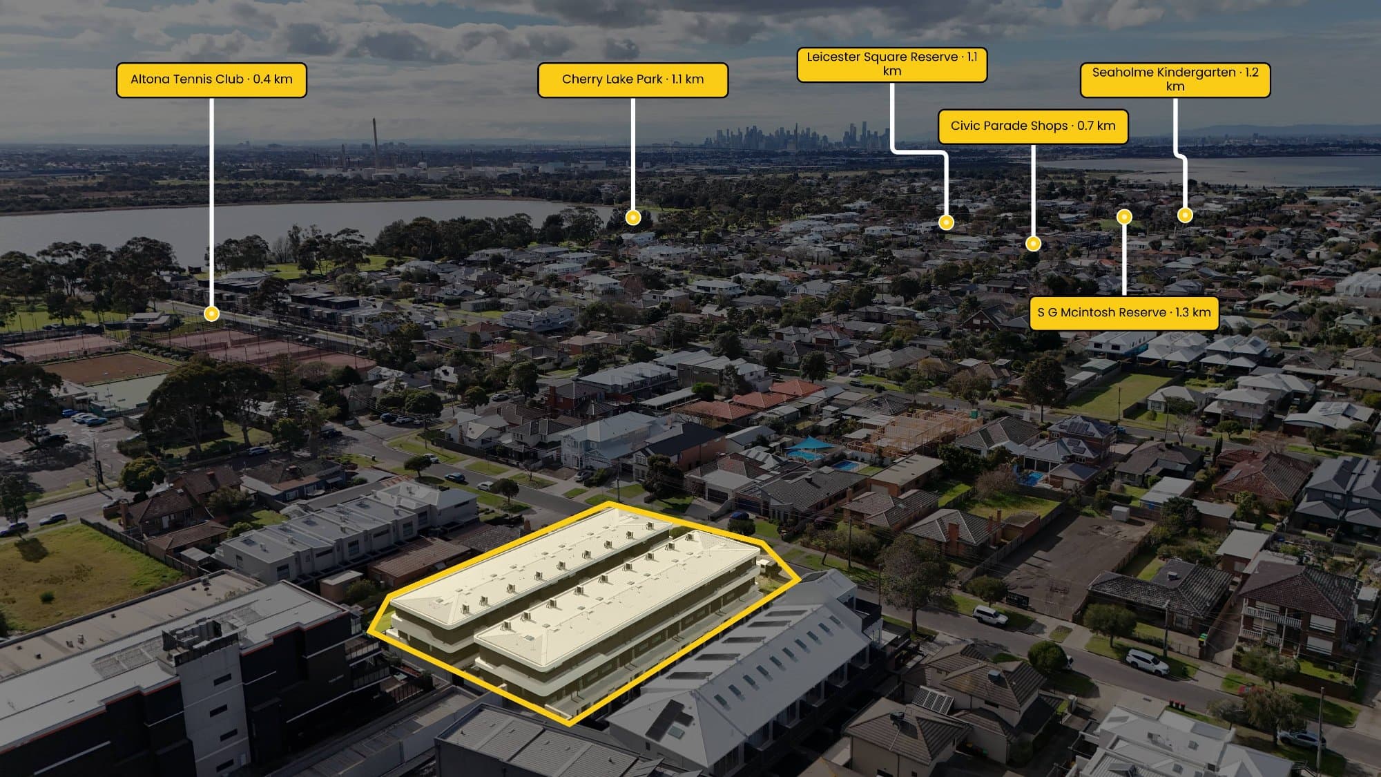
Adding a property outline to a photo is a simple way to show exactly which part of the land you're talking about, especially when you're working with aerial or drone photography.
The basic process is to use a property map or survey as a reference, identify the property's corners, and then draw a line between those points directly on the photograph.
The easiest way
If you're doing it manually, you can open the aerial photo in Photoshop or another image editor, create a new layer, and use the pen or shape tool to trace around the property.
You'll want to use reliable property information as your reference rather than guessing from fences, driveways or landscaping. Those features don't always line up with the actual property boundary.
Once you've traced the outline, you can adjust the line thickness, colour and transparency so it stands out without covering the photo.
Using AerialPin
If you're doing this regularly for real estate photography, AerialPin makes the process much quicker.
You can upload your aerial photo and click around the property to create the boundary directly on the image. The boundary can then be styled with different stroke, fill and spotlight options. You can also display the length of individual edges and calculate the total area.
Once the property is outlined, you can go further by adding nearby schools, parks, shops, transport and other points of interest to the same image.
AerialPin's AI Auto Place can use the GPS, compass heading and gimbal information stored in compatible drone photos to work out which nearby locations are actually visible in the shot and position the pins for you.
One important thing
A property outline added to a marketing photo shouldn't automatically be treated as a legal survey. If you need an exact legal boundary, use the appropriate cadastral or survey information.
For real estate marketing, though, a clean property outline can make an aerial photograph much easier for buyers to understand.