
How Much Time Can You Save Using AerialPin?
Discover how AerialPin helps drone photographers and real estate professionals save hours by automatically adding location insights, points of interest, and interactive features to aerial property images.
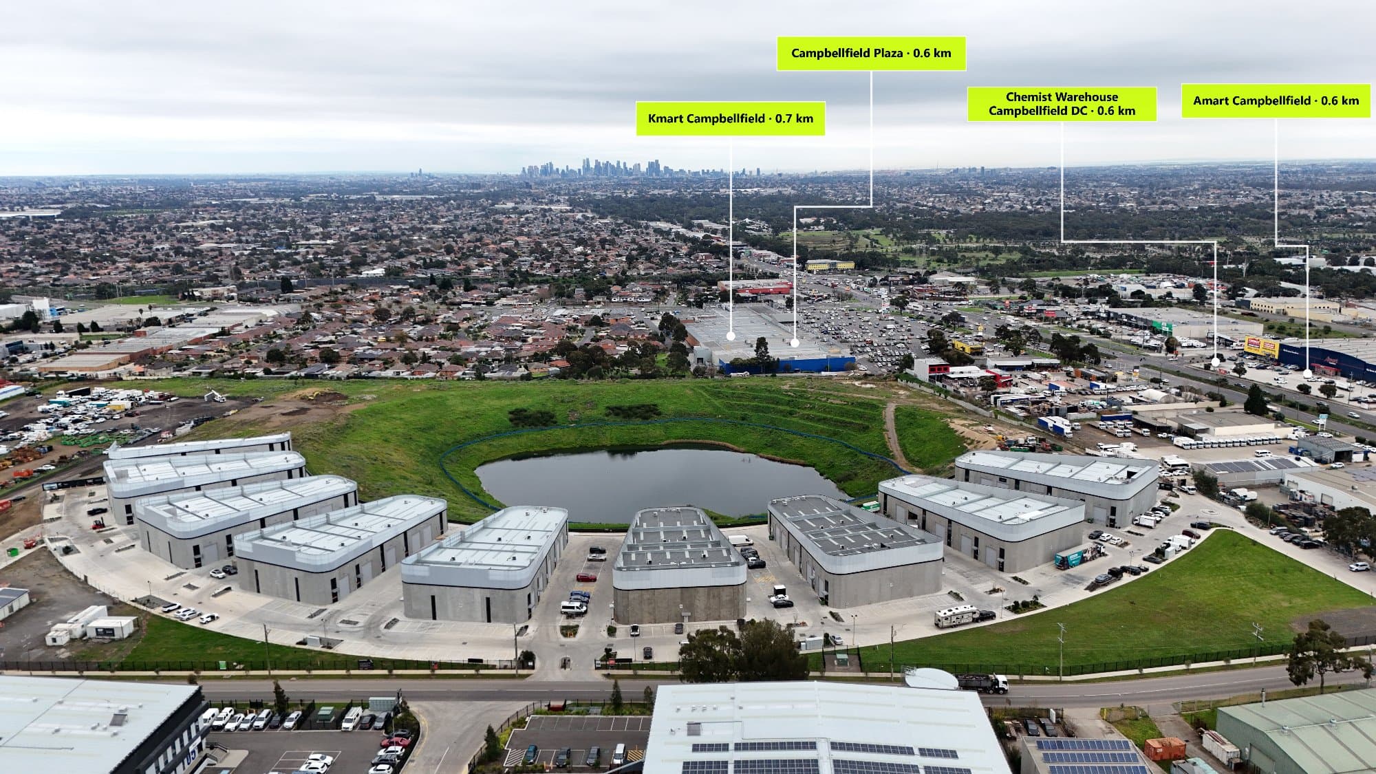
Real estate drone photography is more than just capturing a beautiful image. Modern buyers want to understand the location, lifestyle, and surrounding amenities before making a decision.
Traditionally, adding location information to aerial images requires manually researching nearby schools, cafes, parks, transport, and landmarks — then designing graphics or annotations in editing software.
This process can take valuable time away from photographers.
AerialPin helps streamline this workflow by making aerial images more interactive and informative.
The Traditional Workflow
Without AerialPin, photographers often need to:
- Capture drone images
- Export and edit photos
- Research nearby points of interest
- Find accurate locations
- Create map graphics or labels
- Position annotations manually
- Export final marketing images
For one property, this can easily add 30 minutes or more to the editing process.
When managing multiple listings per week, those extra hours quickly add up.
Save Time With Automatic Location Discovery
AerialPin simplifies the process by helping photographers quickly identify nearby points of interest.
Instead of manually searching:
- Schools
- Cafes
- Shopping centres
- Parks
- Transport
- Landmarks
AerialPin helps you discover and display important nearby locations directly on your aerial images.
Spend Less Time Editing, More Time Shooting
Time saved can be used for:
✅ Taking on more property shoots
✅ Delivering images faster
✅ Creating more premium marketing packages
✅ Growing your photography business
For example:
If you save 30 minutes per property and photograph 10 properties per month:
30 minutes × 10 properties = 5 hours saved every month
That is an entire working afternoon returned to your business.
Create Better Property Marketing in Less Time
Buyers are not only interested in the house — they want to know what surrounds it.
An aerial image showing:
📍 Local schools
☕ Nearby cafes
🌳 Parks and recreation
🚆 Transport options
creates a stronger connection with potential buyers.
AerialPin helps transform a simple drone photo into a complete location experience.
Make Every Aerial Image More Valuable
Professional drone photographers are constantly looking for ways to improve their workflow and deliver more value to clients.
By reducing manual research and creating interactive aerial marketing images faster, AerialPin helps photographers spend less time preparing content and more time growing their business.
Start creating smarter aerial property images today:
Explore features:
https://www.aerialpin.com/features
Get started:
https://www.aerialpin.com/pricing