
How Real Estate Drone Photography Helps Sell Properties Faster
Discover how real estate drone photography helps buyers understand properties better. Learn how aerial images, property boundaries, and interactive points of interest create more engaging property marketing.
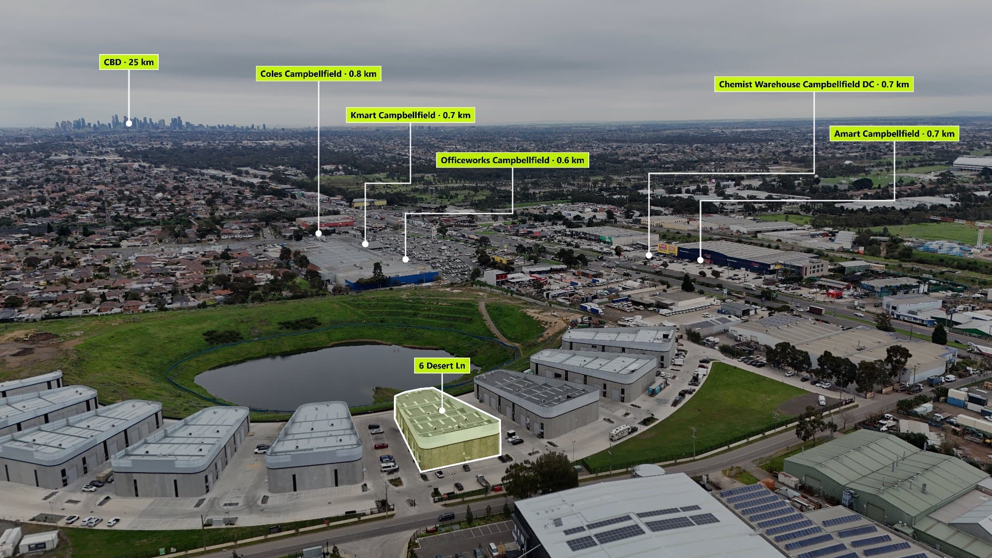
Drone photography has changed the way properties are marketed. Instead of only showing rooms and street-level photos, aerial images give buyers a complete view of the home, land, and surrounding area.
A professional aerial image can instantly communicate property size, location, lifestyle, and features that traditional photography cannot capture.
Why Aerial Images Matter in Real Estate
Buyers want more than just photos of a house. They want to understand:
- How large the block is
- The layout of the property
- Nearby parks and amenities
- Street positioning
- Surrounding neighbourhood features
Aerial photography provides this bigger picture and helps buyers make decisions faster.
Showcase More Than Just the Property
A standard drone image shows the home from above, but adding additional information creates a much stronger marketing experience.
Photographers can highlight:
📍 Property boundaries
🏫 Nearby schools
☕ Local cafes
🌳 Parks and recreation areas
🚆 Public transport
🏬 Shopping centres
This allows buyers to understand the lifestyle that comes with the property.
Turn Aerial Photos Into Interactive Experiences
Modern real estate marketing is becoming more interactive.
Instead of buyers simply looking at an image, they can explore important information directly from the aerial photo.
AerialPin allows photographers and agents to add interactive points of interest to drone images, helping showcase everything that makes a location valuable.
Save Time Creating Property Marketing Content
Creating location-based aerial graphics manually can involve:
- Searching for nearby locations
- Creating map overlays
- Designing labels
- Editing images
- Exporting multiple versions
AerialPin simplifies this workflow, allowing photographers to create professional aerial marketing images faster.
Stand Out From Other Real Estate Photographers
The real estate photography industry is competitive. Offering something different can help photographers provide more value to agents and sellers.
Interactive aerial images can become a premium marketing feature that helps listings stand out online.
Instead of only showing where a property is, show buyers why the location matters.
Create Better Aerial Marketing With AerialPin
Whether you are a drone photographer, real estate agent, or property marketer, AerialPin helps transform aerial images into engaging property experiences.
Show boundaries. Highlight locations. Tell the complete property story.
Learn more:
https://www.aerialpin.com
Explore features:
https://www.aerialpin.com/features
Start creating interactive aerial images:
https://www.aerialpin.com/pricing