
How to Add Distance Measurements to Property Photos
Learn how to add distance measurements to aerial property photos. Highlight nearby amenities, roads, access points and important property features.
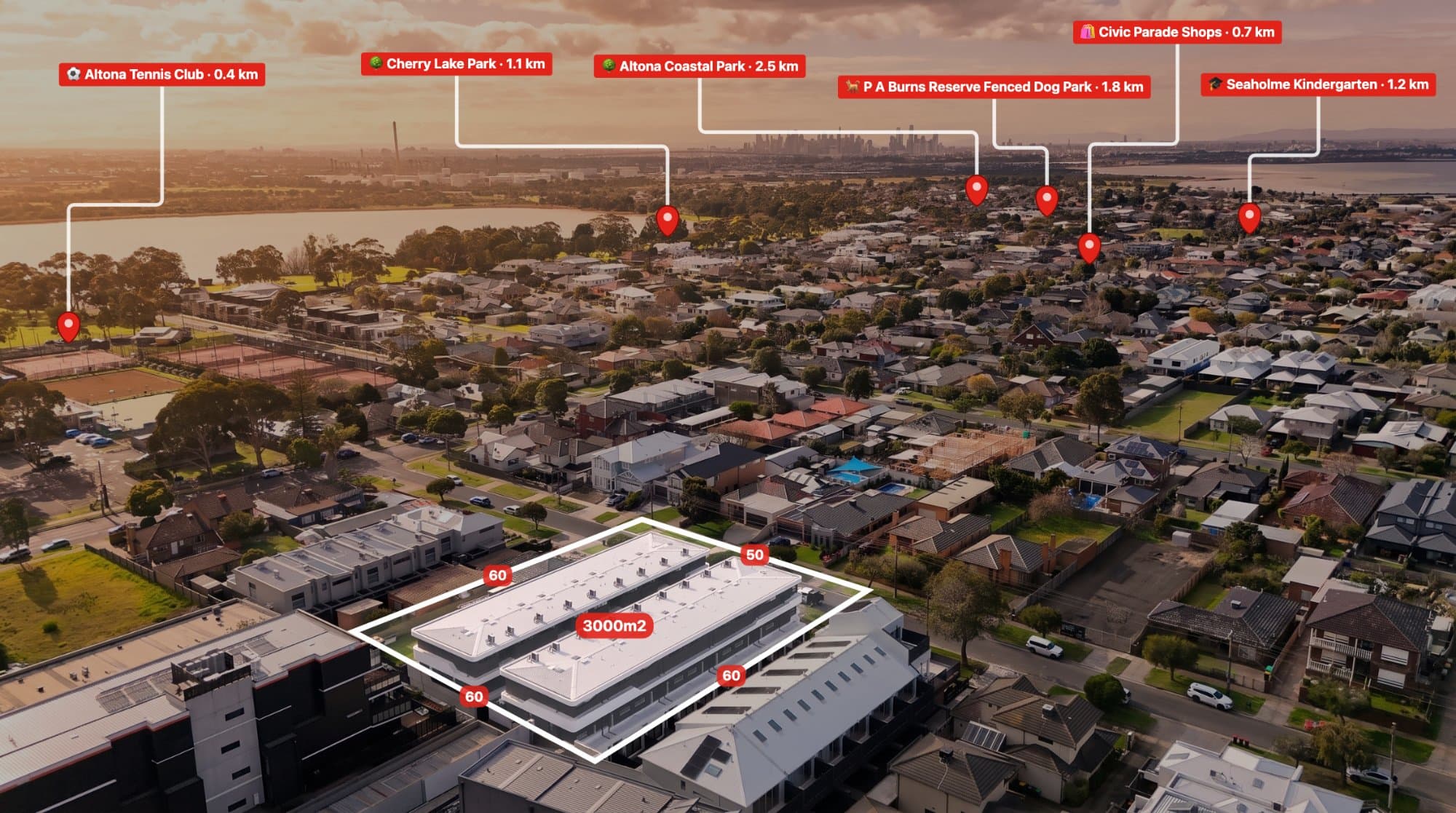
When buyers look at a property, they often want to understand how close it is to important locations.
How far is the nearest school? How close is the shopping centre? What is the distance between the property and the main road?
These are useful questions, and aerial imagery provides an opportunity to answer them visually.
Adding distance measurements to property photographs can make real estate marketing more informative.
Why add measurements to aerial photographs?
Distance annotations can help highlight:
-
The distance to nearby schools.
-
The distance to shopping centres.
-
Access to major roads.
-
The distance to parks and recreational areas.
-
The layout of large properties.
-
The separation between important site features.
For acreage and vacant land, measurements can also help communicate the scale of a property.
How to add distance measurements to an aerial photo
Step 1: Choose your aerial photograph
Select a high-quality photograph where the relevant locations or property features are visible.
For the clearest presentation, use an image with enough space to display measurement lines and labels.
Step 2: Identify the points you want to measure
Choose two locations that are relevant to the property.
For example:
-
The property and a nearby park.
-
The property and a shopping centre.
-
Two points within a large block of land.
-
A property entrance and a visible building.
Step 3: Draw the measurement line
Use a measurement annotation tool to identify the starting point and ending point.
Position the line carefully and make sure it does not cover important parts of the image.
Step 4: Add the distance label
Display the measurement using an appropriate unit.
Depending on the audience and location, this may be metres or kilometres.
Keep labels easy to read and avoid using too many measurements on one image.
Step 5: Check what the measurement represents
This step is important.
A straight-line distance between two points is not necessarily the same as driving, walking or road distance.
For example, a shopping centre may be 800 metres away in a straight line, but the actual road route may be considerably longer.
Always describe the measurement accurately.
How AerialPin helps with property distance annotations
AerialPin includes measurement and annotation tools that help users communicate distances on aerial property photographs.
You can combine measurements with:
-
Property boundaries.
-
Location pins.
-
Labels.
-
Nearby amenities.
-
Custom annotations.
This allows real estate photographers and agents to produce more informative aerial marketing images.
Explore AerialPin.
Tips for professional-looking measurement annotations
Keep it simple. Only show measurements that provide useful information.
Use consistent styling. Keep measurement lines, labels and colours consistent.
Avoid clutter. Don't cover important property features with unnecessary graphics.
Use accurate information. Ensure measurements are based on an appropriate source and clearly identify what is being measured.
Frequently asked questions
Can I measure distances on aerial photographs?
Yes, using suitable measurement tools and properly calibrated or georeferenced imagery. Measurements on ordinary perspective photographs may not be accurate without additional spatial information.
Can I show the distance from a property to a school?
Yes. You can display a distance between the property and a school, provided the distance type is clearly explained.
What is the difference between straight-line distance and driving distance?
Straight-line distance measures the direct distance between two points. Driving distance follows the available road network.
Can I add multiple measurements to one image?
Yes. However, keep the layout clean and only include measurements that help the viewer understand the property.