
How to Add Outlines to Images for Real Estate Marketing
Learn how to add property outlines to real estate images and aerial photos. Discover how AerialPin helps photographers create professional property boundary overlays and location-focused marketing images.
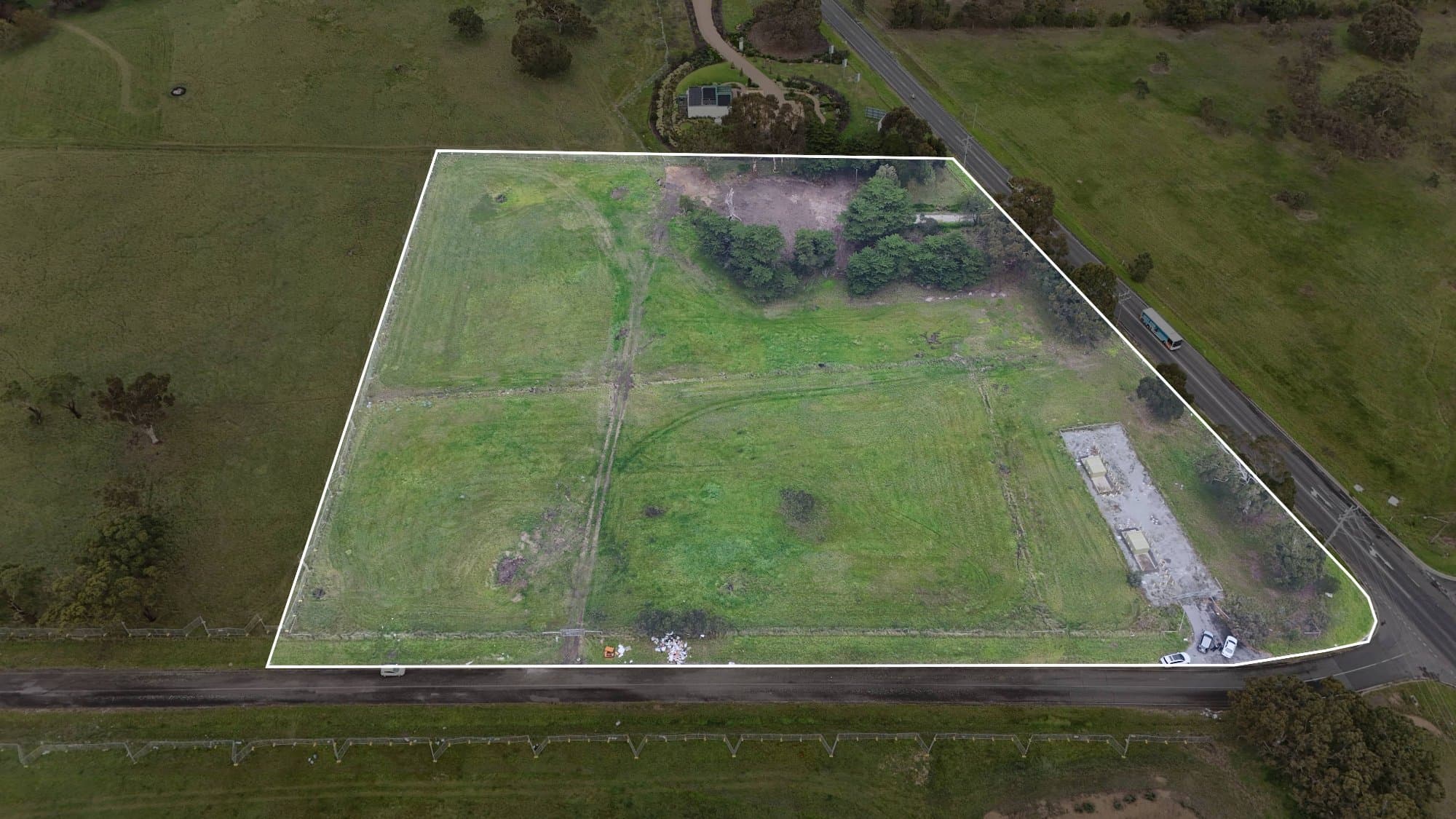
Real estate marketing is becoming more visual than ever. Buyers want to quickly understand a property's layout, boundaries and surrounding features before they even inspect the home.
Aerial images are especially useful because they show the relationship between the property and the surrounding area. However, without additional information, it can sometimes be difficult for viewers to understand exactly where the property begins and ends.
Adding outlines to real estate images helps solve this problem.
Property outlines, boundary lines and visual overlays can highlight the exact area of interest, making aerial images easier to understand and more valuable for buyers.
With tools like AerialPin, photographers and property marketers can create clearer aerial marketing images with professional overlays.
Why Add Outlines to Real Estate Images?
An aerial photo provides a great overview of a property, but viewers may not immediately understand:
- The property boundary
- The land size
- The building footprint
- The location within the neighbourhood
- The relationship to nearby features
Adding an outline creates instant visual clarity.
For buyers, it makes the image easier to interpret. For agents and developers, it creates a more professional marketing presentation.
Common Uses for Property Outlines
Property outlines are commonly used for:
Residential Properties
Highlight:
- Lot boundaries
- Backyard areas
- Driveways
- Landscaping areas
Acreage Properties
Large properties often benefit from outlines that show:
- Total land area
- Farm boundaries
- Multiple structures
- Access points
New Developments
Developers can use outlines to show:
- Individual lots
- Future stages
- Building locations
- Development areas
Commercial Properties
Outlines can highlight:
- Site boundaries
- Parking areas
- Buildings
- Available spaces
How to Add Outlines in Photoshop
One common way to add property outlines is through Photoshop.
The manual process usually involves:
- Opening the aerial image
- Creating a new layer
- Using the Pen Tool to trace the property boundary
- Creating a path around the area
- Applying a stroke line
- Adjusting opacity and colour
- Exporting the final image
This method provides creative control but requires time and accuracy.
The Challenges With Manual Outlines
Creating outlines manually can become difficult when working with multiple properties.
Common challenges include:
- Finding accurate boundaries
- Tracing large areas
- Keeping designs consistent
- Spending time on repetitive edits
- Maintaining accuracy from aerial perspectives
For one image, this process may be manageable.
For photographers producing many listings each month, it can become a time-consuming task.
What Makes a Professional Property Outline?
A good real estate outline should be:
Accurate
The outline should represent the correct property area.
Clean
The design should improve the image without distracting from the property.
Consistent
Professional marketing should use the same style across multiple images.
Easy to Understand
Buyers should immediately know what the outline represents.
How AerialPin Helps With Aerial Image Overlays
AerialPin helps photographers create smarter aerial marketing images by combining drone photography with location-based information.
Instead of manually creating every visual element, photographers can streamline their workflow and create more informative images.
AerialPin is designed to help with:
- Aerial image annotation
- Location overlays
- Point of Interest labels
- Professional marketing exports
This allows photographers to spend less time editing and more time creating content.
Property Outlines vs Point of Interest Labels
Both features add value to aerial marketing, but they communicate different information.
Property Outlines
Show:
- The property's boundaries
- Land size
- Building placement
- Development areas
Point of Interest Labels
Show:
- Nearby schools
- Parks
- Shopping centres
- Transport
- Local attractions
Combining both creates a complete visual story of the property and its location.
Why Real Estate Professionals Use Image Overlays
Professional overlays help properties stand out by making images more informative.
They help buyers understand:
- What they are viewing
- Where the property sits
- What surrounds the location
- Why the area is valuable
Instead of simply showing an aerial image, overlays turn the image into a marketing tool.
Who Uses Property Image Outlines?
Real Estate Photographers
Create premium aerial packages for agents.
Real Estate Agents
Present properties with clearer marketing visuals.
Builders
Show project boundaries and development progress.
Property Developers
Communicate land opportunities and project layouts.
The Future of Real Estate Image Editing
Real estate photography is moving towards smarter visual communication.
Buyers want images that provide information, not just attractive visuals.
AI-powered platforms are helping photographers create better marketing assets faster by reducing repetitive editing tasks.
With AerialPin, aerial photographers can create more informative images that combine professional photography with useful location data.
Final Thoughts
Adding outlines to real estate images is an effective way to improve buyer understanding and create more professional marketing material.
While traditional tools like Photoshop allow manual editing, automated workflows help photographers save time and maintain consistency.
By combining aerial photography, property outlines and location information, professionals can create marketing images that tell the complete story of a property.
With AerialPin, photographers can create better aerial marketing content and deliver more value to their clients.