
How to Add Places to Drone Photos for Real Estate
Learn how to add places to drone photos for real estate. Show nearby schools, parks, shopping centres, transport and other important locations.
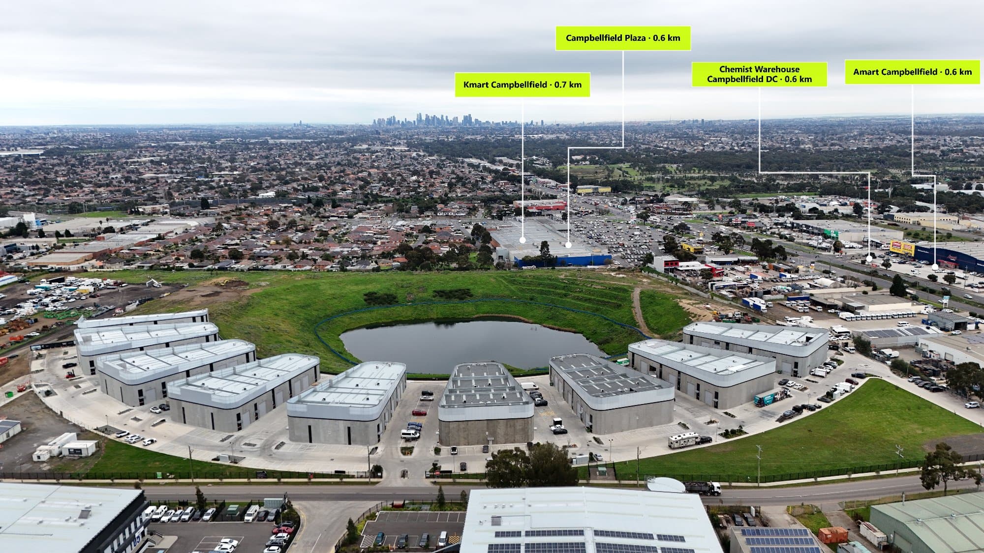
Drone photos are one of the best ways to show a property, but sometimes buyers want to know more than just what the house looks like from above.
They want to know:
- Is there a school nearby?
- How far is the shopping centre?
- Is public transport close?
- Are there parks or cafés nearby?
By adding places to drone photos, you can show buyers what is around the property and create more useful real estate marketing images.
What Are Places on Drone Photos?
Adding places to a drone photo means putting labels or markers on an aerial image to show important locations nearby.
These are also called:
- Points of Interest (POI)
- Map markers
- Location labels
- Drone photo annotations
Instead of making buyers search for the area themselves, you can show everything they need directly on the image.
Why Add Places to Real Estate Drone Photos?
A normal drone photo shows the home.
An annotated drone photo shows the lifestyle.
Adding nearby places helps buyers understand:
- The property's location
- Nearby facilities
- The convenience of the area
- Why the suburb is attractive
This can make a property listing more professional and easier for buyers to understand.
The Best Places to Add to Drone Photos
Schools
Schools are one of the most important things families look for when buying a home.
Add:
- Primary schools
- High schools
- Private schools
- Childcare centres
Shopping Centres
Show buyers where they can shop and access everyday essentials.
Examples:
- Shopping centres
- Supermarkets
- Local stores
- Retail areas
Parks
Parks help show the lifestyle around a property.
Include:
- Playgrounds
- Walking tracks
- Dog parks
- Sporting fields
Public Transport
Transport is important for many buyers.
Highlight:
- Train stations
- Bus stops
- Tram stops
- Major roads
Cafés and Restaurants
Nearby dining can make a location more appealing.
Add:
- Cafés
- Restaurants
- Bakeries
- Entertainment areas
How Do You Add Places to a Drone Photo?
There are a few ways to add locations to drone images.
Manual Method
You can:
- Open Google Maps
- Find nearby locations
- Edit the drone image in Photoshop or Canva
- Add labels manually
This works, but it can take a lot of time.
Automatic Method
A faster option is using software that can find nearby places automatically.
AerialPin helps real estate photographers quickly add nearby Points of Interest to drone photos.
Instead of searching for every school, park, or shopping centre yourself, AerialPin helps create professional property images faster.
Who Should Use Drone Photo Location Labels?
Adding locations to drone photos is useful for:
- Real estate photographers
- Real estate agents
- Property developers
- Builders
- Marketing companies
It is especially useful for properties where location is a major selling point.
Make Your Drone Photos More Valuable
Aerial photography already makes listings stand out, but adding nearby locations gives buyers more information.
A simple drone photo shows a property.
A drone photo with Points of Interest shows buyers what life around the property looks like.