
How to Add Property Boundaries to Drone Images for Real Estate
Add property boundaries to aerial drone images and help buyers understand land size, property layout, and surrounding features. Learn how AerialPin creates more engaging real estate marketing images with interactive location details.
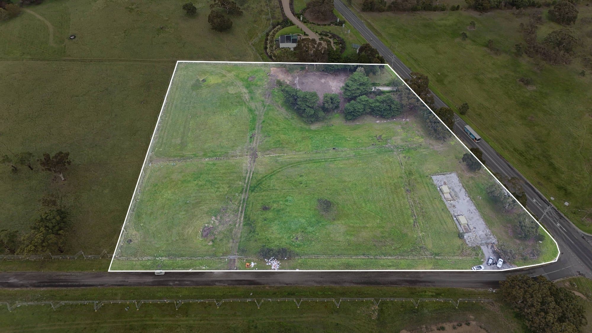
Aerial photography gives buyers a unique view of a property, but sometimes it is difficult to understand exactly where the land begins and ends.
Adding property boundaries to aerial images helps buyers quickly understand the lot size, usable space, and the relationship between the home and surrounding land.
With AerialPin, drone photographers can create more informative aerial property images by adding interactive location features and visual information directly onto their photos.
Why Add Boundaries to Aerial Images?
Property boundaries make aerial marketing clearer by showing:
- The exact land area
- Property size and shape
- Driveways and access points
- Backyard space
- Landscaping areas
- Future development opportunities
For buyers, a boundary overlay can make a property easier to understand before they even attend an inspection.
Traditional Way of Adding Boundaries
Previously, photographers often had to:
- Find property survey information
- Import maps into design software
- Manually trace boundary lines
- Match the map with the aerial photo
- Export multiple versions
This process can take significant time, especially when preparing multiple listings.
Creating Professional Boundary Overlays
A professional property boundary overlay should be:
Accurate
The boundary should match the actual property lines and location.
Subtle
Avoid large distracting lines that cover important details.
Easy to Understand
Use clean lines, labels, and markers so buyers immediately understand the property layout.
Combine Boundaries With Points of Interest
The best aerial marketing images tell the complete property story.
Instead of only showing the lot, photographers can highlight:
📍 Property boundary
🏫 Nearby schools
☕ Cafes and restaurants
🌳 Parks
🚆 Transport links
🏖 Local attractions
This helps buyers understand not only the home but the lifestyle around it.
Make Aerial Images More Valuable With AerialPin
AerialPin helps drone photographers transform standard aerial photos into interactive property marketing tools.
Create aerial images that showcase:
- Property boundaries
- Nearby amenities
- Important locations
- Property features
Give buyers more information without making them search elsewhere.
Learn more:
https://www.aerialpin.com
Explore features:
https://www.aerialpin.com/features
Start creating interactive aerial images:
https://www.aerialpin.com/pricing