
How to Add Real Estate Property Boundary Lines to Drone Photos
Learn how to add real estate property boundary lines to drone photos and create clear aerial marketing images that show buyers exactly which land belongs to the property.
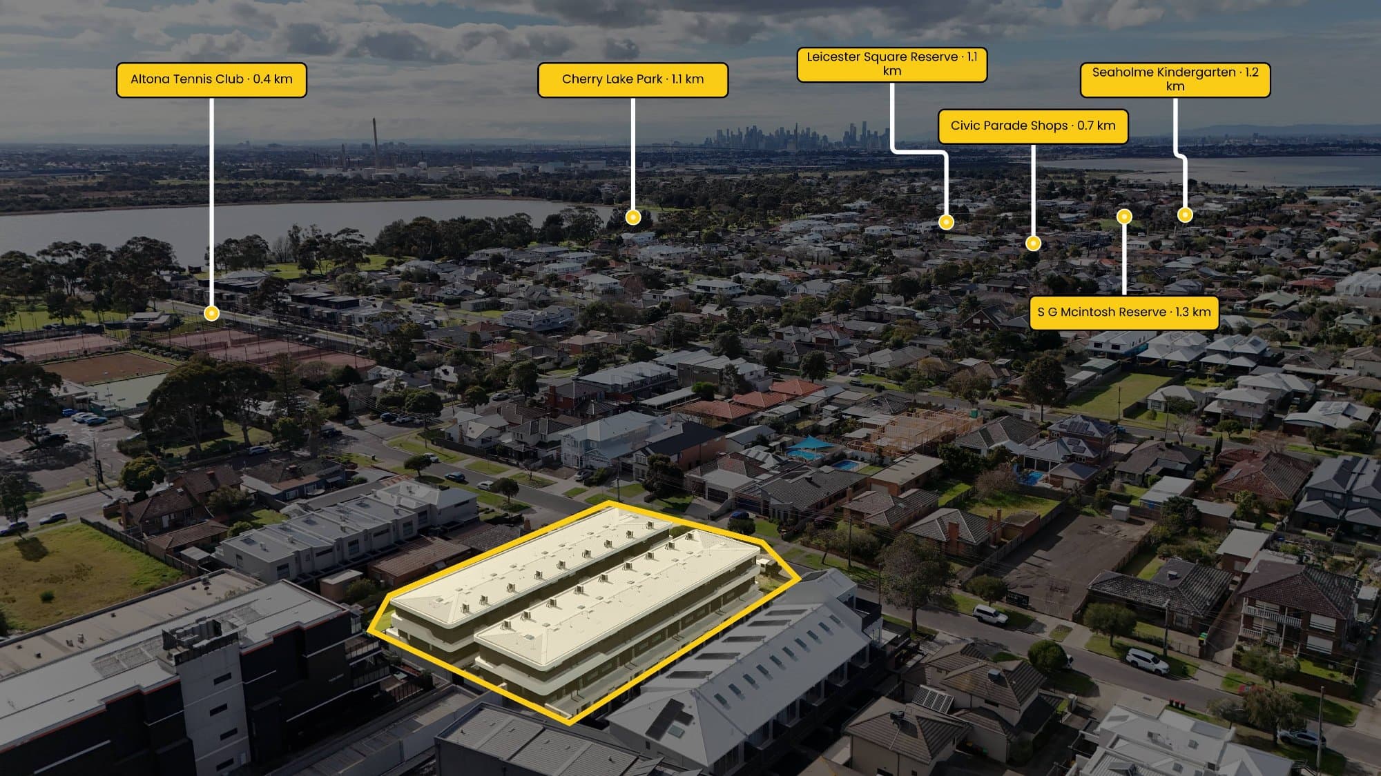
Drone photography gives real estate listings a great view of the property, but sometimes the biggest question is also the simplest: where does the property actually end?
From the air, fences can be difficult to see, neighbouring blocks can look almost identical and large properties can be hard to understand.
Adding a property boundary line solves that problem by giving the viewer a clear outline of the land.
Why Add Property Boundaries to Drone Photos?
A boundary line can make a big difference to how an aerial photograph is understood.
This is particularly useful for:
- Large residential blocks
- Acreage properties
- Corner blocks
- Properties with large backyards
- Vacant land
- Development sites
- Properties where the boundary isn't obvious from the air
Instead of asking the buyer to work out where the property ends, you can show them directly on the image.
How Do You Add the Boundary?
The first thing you need is a reliable reference for the property's boundary.
This could come from property mapping, cadastral information, a property plan or other reliable data.
Once you know where the boundary sits, you can overlay it onto your drone photograph.
The traditional approach is to open the image in Photoshop, create a new layer and manually trace the boundary using the pen or shape tool.
You can then adjust the line thickness, colour and transparency until it looks right.
It works, but if you're doing this for multiple real estate listings, it can become a fairly repetitive process.
Using AerialPin
AerialPin was built specifically for working with aerial property images.
Instead of building the boundary graphic from scratch in Photoshop, you can upload your drone photo and create the property boundary directly over the image.
You can customise the boundary line, add a fill, adjust transparency and add labels to create a consistent style across your property photography.
This makes it particularly useful for photographers who are producing aerial marketing images for agents on a regular basis.
Make the Aerial Image More Useful
A property boundary doesn't have to be the only information on the image.
Once you've outlined the property, you can also show nearby locations that may be important to a buyer.
For example, you could highlight:
- Schools
- Parks
- Shopping centres
- Train stations
- Sporting facilities
- Beaches
- Major roads
AerialPin's AI Auto Place can help identify nearby points of interest from compatible drone photos and place them on the image based on the camera's location and orientation.
That means you can turn a standard drone photograph into something that gives the buyer a better understanding of both the property and its surroundings.
Keep the Design Simple
It's easy to get carried away with aerial annotations.
A property boundary should make the image easier to understand, not cover it in graphics.
A clean boundary line, a subtle fill and a simple property label are often enough.
If you're adding points of interest, choose only the locations that are genuinely useful to someone considering the property.
The finished image should still look like a professional real estate photograph.
Property Boundaries vs Legal Surveys
It's important to remember that a boundary drawn onto a marketing image is not necessarily a legal survey.
Property data and visible features in aerial photography don't always provide survey-level accuracy. If an exact legal boundary is required, use appropriate cadastral or survey information and consult a qualified professional.
For marketing purposes, however, a clearly marked boundary can be an excellent way to help buyers understand the property.
Turn Your Drone Photos Into Better Property Marketing Images
Aerial photography already gives real estate agents something that ground-level photography can't.
Adding a property boundary takes it one step further.
Instead of simply showing the house from above, you can show the house, the land and what's around it in a single image.
If you're regularly creating aerial property marketing content, AerialPin can help speed up the process by bringing property boundaries, labels, points of interest and automatic placement into one workflow.
Try AerialPin and create your next annotated aerial property image.