
How to Annotate Aerial Photos Online
Learn how to annotate aerial photos online with property labels, location pins, boundaries and distance measurements. Make drone photos more informative.
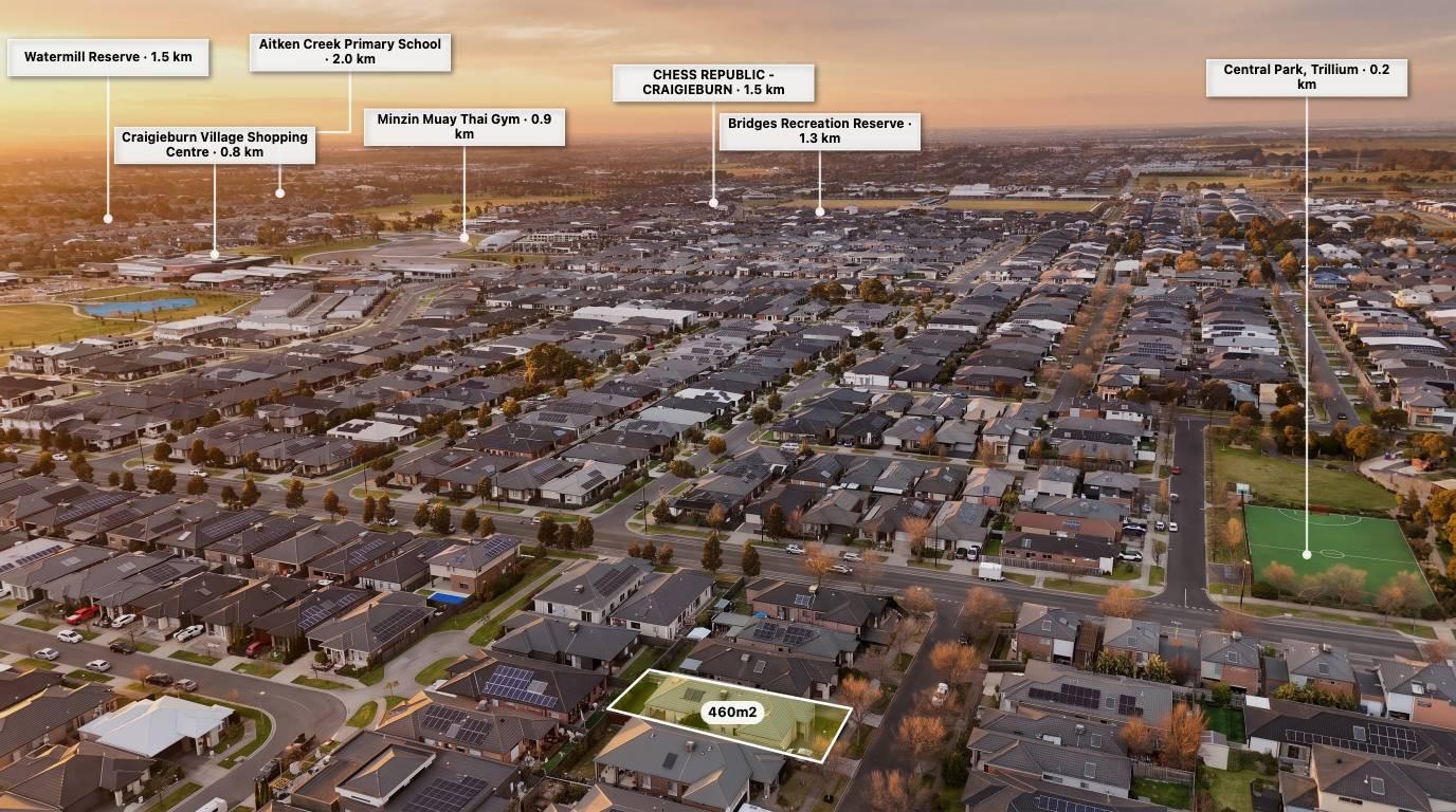
Aerial photography gives buyers a better understanding of a property's size, surroundings and location. But sometimes a standard drone photo doesn't tell the whole story.
Adding labels, property boundaries, location pins and distance measurements can turn a simple aerial image into a useful property marketing visual.
The good news is that you don't need complicated editing software to do it. You can annotate aerial photos directly in your browser using online tools such as AerialPin.
What does it mean to annotate an aerial photo?
Annotating an aerial photo means adding visual information to an image to help people understand what they are looking at.
Common annotations include:
-
Property boundaries and land outlines.
-
Location pins identifying nearby amenities.
-
Labels showing schools, parks and shopping centres.
-
Distance measurements between important locations.
-
Custom markers highlighting property features.
-
Text and callouts identifying roads, buildings and access points.
These additions make aerial imagery easier to understand, especially when marketing large properties, vacant land or development sites.
How to annotate an aerial photo online
Step 1: Upload your aerial photograph
Start with a high-quality aerial image from your drone or camera. For the best results, choose an image where the property and surrounding area are clearly visible.
Step 2: Add property boundaries
Use a boundary tool to outline the relevant land area. You can adjust the shape and position of the boundary to match your intended presentation.
Always verify boundary information against an appropriate property or cadastral source. A drone photograph alone does not establish legal property boundaries.
Step 3: Add location pins
Highlight nearby points of interest such as schools, parks, shopping centres, public transport and major roads.
Location pins help potential buyers understand the surrounding neighbourhood without having to research every location themselves.
Step 4: Add labels and measurements
Use labels to identify important features and measurements to communicate distances.
For example, you could show the distance from a property to a nearby shopping centre or highlight the size of a particular area.
Step 5: Customise the design
Adjust colours, icons, text sizes and line styles to suit the property and your client's branding.
Keep the design clean. Too many labels can make an aerial photo difficult to understand.
Step 6: Export your finished image
Once you're happy with the result, export the annotated image and use it in property listings, marketing campaigns, brochures or social media.
Why annotate aerial photos?
Annotated aerial photography can help:
-
Give buyers a better understanding of a property's surroundings.
-
Highlight nearby amenities.
-
Communicate land size and layout visually.
-
Showcase development opportunities.
-
Make property marketing more informative.
-
Help real estate photographers offer additional services.
Annotate aerial photos with AerialPin
AerialPin is an online aerial photo annotation tool designed for real estate professionals and drone photographers.
Upload an image, add boundaries, place location pins, show distances and customise your annotations in one browser-based workflow.
You can also use GPS information from supported drone photographs to help position location information.
Explore the AerialPin online editor.
Frequently asked questions
Can I annotate aerial photos without Photoshop?
Yes. Online annotation tools allow you to add labels, pins, boundaries and measurements without needing a full image editing application.
Can I add property boundaries to drone photos?
Yes. You can manually draw or adjust boundary outlines, or use suitable geographic data to guide their placement. Always verify the source before presenting boundaries as accurate.
Can I add location pins to aerial photos?
Yes. Location pins can identify nearby amenities, roads, facilities and other important points of interest.
What is the best format for an annotated aerial photo?
A high-resolution JPG or PNG is generally suitable for property marketing, websites and social media.