
How to Make Drone Photos Better for Real Estate Listings
Learn how to improve real estate drone photos by adding nearby locations, schools, parks, transport and points of interest for buyers.
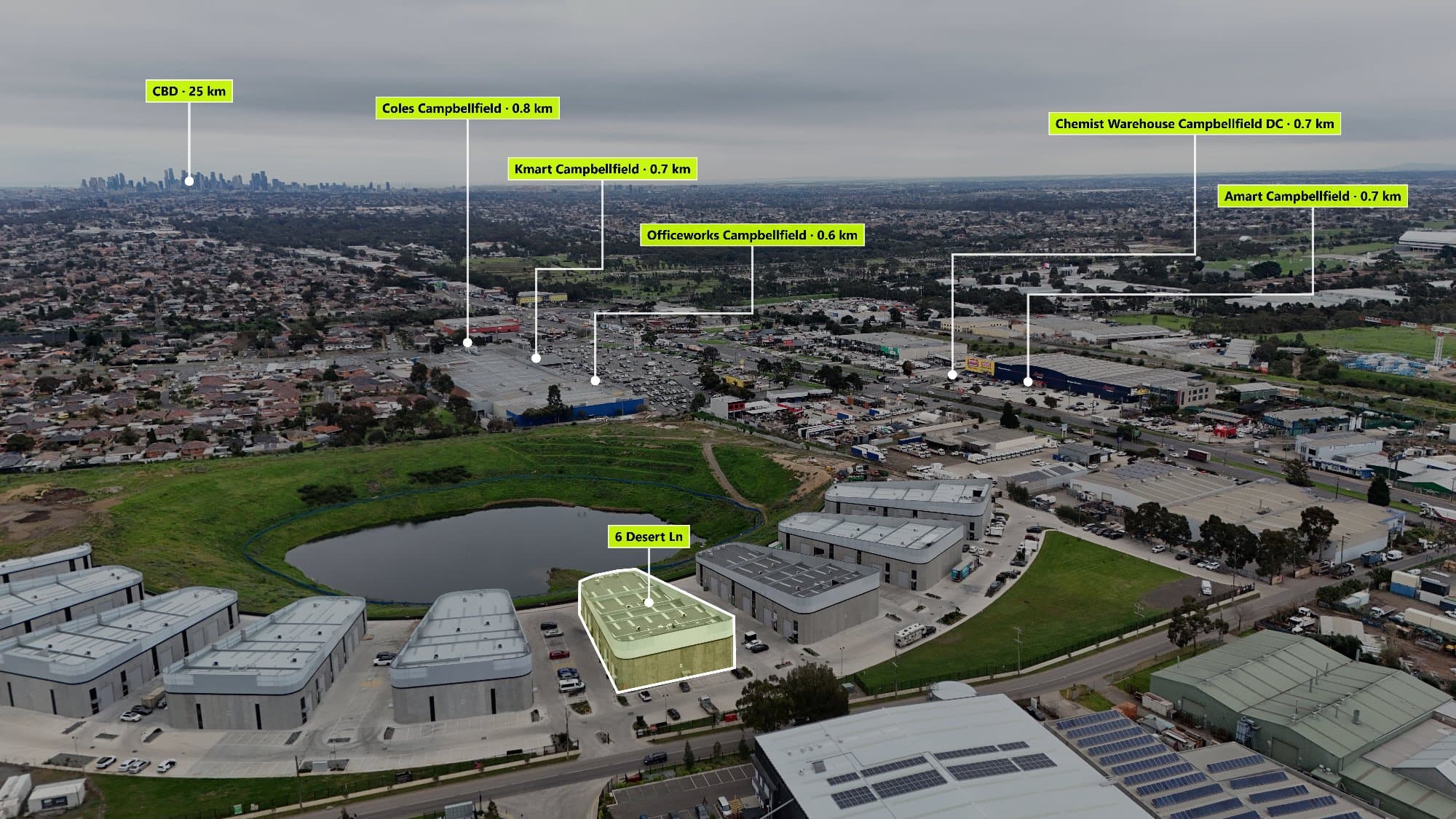
A drone photo can make a property look impressive, but buyers also want to understand what is around the home.
A beautiful aerial image shows the property. A great real estate drone image shows the property and the lifestyle that comes with it.
Adding nearby locations, also known as Points of Interest (POI), is one of the easiest ways to make drone photos more useful for buyers.
Why Add Nearby Locations to Drone Photos?
When people buy a home, they are not only buying the house. They are buying the location.
Buyers want to know:
- How close are schools?
- Where is the nearest shopping centre?
- Is public transport nearby?
- Are there parks or recreation areas?
- What makes this suburb a good place to live?
Adding location markers directly onto a drone photo gives buyers this information instantly.
What Should You Add to a Real Estate Drone Photo?
The best locations to highlight are places that make the property more attractive.
Schools
For families, schools are often one of the biggest deciding factors.
Useful locations include:
- Primary schools
- High schools
- Private schools
- Childcare centres
Shopping
Show buyers where they can easily access everyday needs.
Examples:
- Shopping centres
- Supermarkets
- Local shops
- Retail areas
Transport
Easy travel can increase the value of a property.
Consider adding:
- Train stations
- Bus stops
- Tram lines
- Freeway entrances
Parks and Recreation
Outdoor areas help buyers imagine their lifestyle.
Add:
- Parks
- Playgrounds
- Sports clubs
- Walking tracks
- Golf courses
Food and Entertainment
Lifestyle locations can make a suburb more appealing.
Include:
- Cafés
- Restaurants
- Entertainment areas
- Popular local attractions
How Do Real Estate Photographers Add Locations?
Many photographers manually search for nearby places and add labels using editing software.
The process usually looks like:
- Upload the drone image
- Search Google Maps for nearby locations
- Create labels or icons
- Place them onto the image
- Export the final photo
This works, but it can take a lot of time when creating multiple property listings.
A Faster Way to Add Points of Interest
Instead of manually searching every nearby location, photographers can use software designed for drone photo annotations.
AerialPin helps real estate photographers find nearby Points of Interest and add them to aerial images quickly.
With AerialPin, you can create professional drone photos that show:
- Nearby schools
- Parks
- Shopping centres
- Transport
- Local attractions
This helps photographers deliver more value to real estate agents and create marketing material that stands out.
Why Agents Like Annotated Drone Photos
Real estate agents use drone photos with location markers because they help buyers understand the property faster.
They can be used for:
- Real estate listings
- Social media posts
- Property websites
- Buyer presentations
- Marketing campaigns
A buyer may not know the suburb, but a simple aerial image with clear locations can quickly show them why the area is attractive.
Create More Valuable Property Marketing Images
The best real estate photography does more than show a home. It helps buyers picture their future lifestyle.
Adding nearby locations to drone photos is a simple way to turn an ordinary aerial image into a more informative and professional marketing tool.