
Why Aerial Drone Photography Is Essential for Real Estate Marketing
In today's competitive property market, buyers expect more than just interior photos. They want to understand the property's surroundings, nearby amenities, land size, and overall lifestyle before scheduling an inspection.
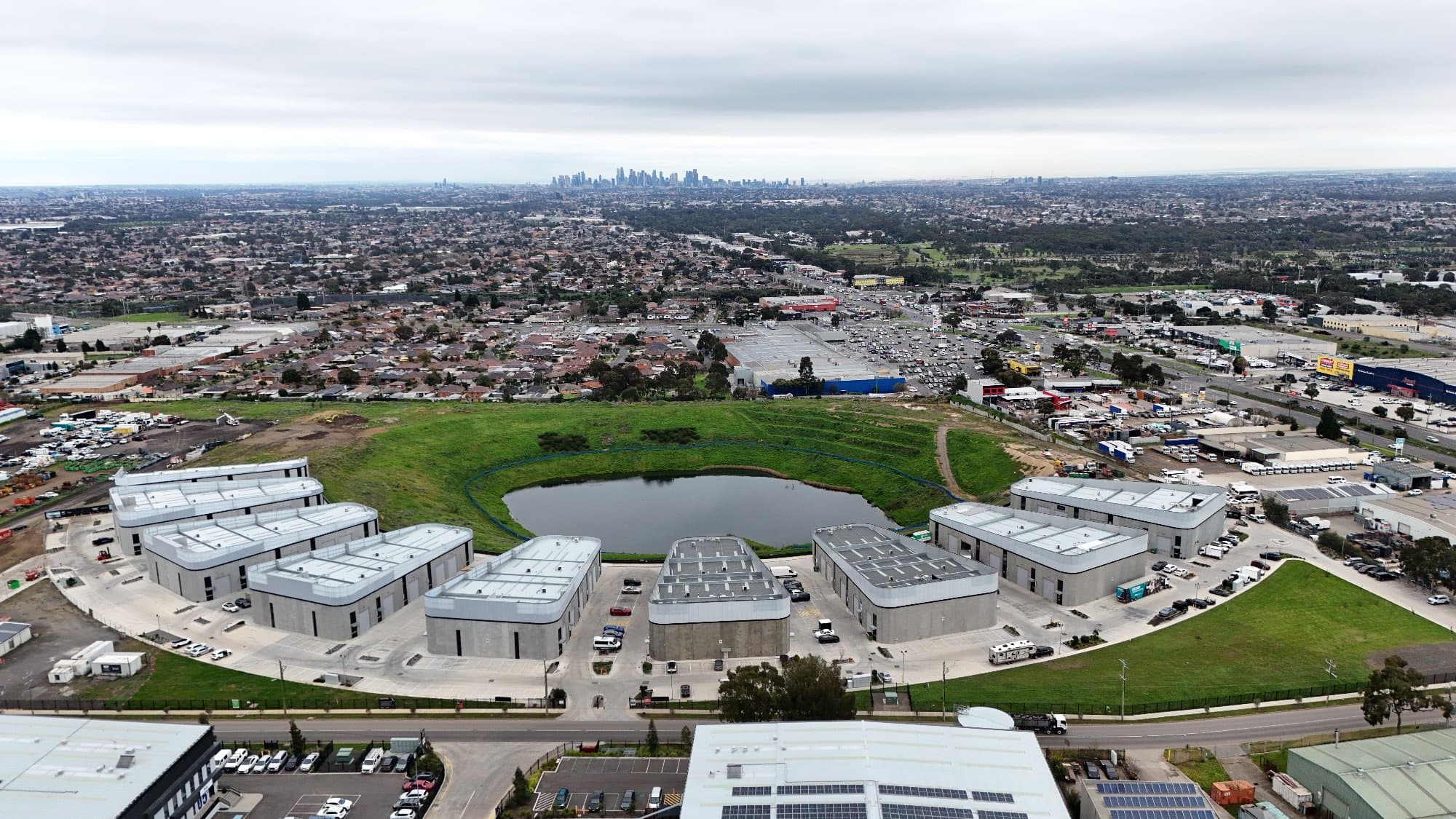
In today's competitive property market, buyers expect more than just interior photos. They want to understand the property's surroundings, nearby amenities, land size, and overall lifestyle before scheduling an inspection.
That's where aerial drone photography has become one of the most powerful tools in modern real estate marketing.
Professional drone imagery helps listings stand out online, generates more engagement, and gives buyers a complete understanding of the property—all from a single image.
What Is Aerial Real Estate Photography?
Aerial real estate photography uses drones equipped with high-resolution cameras to capture properties from above.
Unlike traditional ground photography, aerial images reveal:
- Property boundaries
- Backyard and outdoor entertaining areas
- Swimming pools
- Landscaping
- Nearby parks
- Schools
- Shopping centres
- Public transport
- Beaches, rivers, lakes, or city views
This additional context helps buyers visualise not only the home itself, but the lifestyle that comes with it.
Why Drone Photography Helps Sell Homes Faster
Showcase the Entire Property
Large homes, acreage, and premium properties deserve more than standard photography.
Drone imagery captures the full layout of the property, allowing buyers to appreciate:
- Land size
- Driveways
- Gardens
- Outdoor entertaining areas
- Roof condition
- Overall property flow
Highlight the Location
Location is one of the biggest factors influencing purchasing decisions.
Aerial photography visually demonstrates proximity to:
- Schools
- Shopping precincts
- Train stations
- Parks
- Walking trails
- Beaches
- Business districts
Rather than simply mentioning nearby amenities, buyers can actually see how close they are.
Increase Listing Engagement
Properties featuring professional aerial photography often receive more attention across:
- Real estate websites
- Social media
- Google Business Profiles
- Digital brochures
- Email campaigns
Eye-catching aerial images encourage more clicks, longer viewing times, and stronger buyer interest.
The Power of Annotated Drone Photos
Aerial photography becomes even more valuable when combined with professional annotations.
Adding labels for nearby amenities, property boundaries, parks, schools, and transport routes helps buyers instantly understand the property's location and key selling points.
Instead of manually creating these graphics in Photoshop, photographers can now automate much of the process using software built specifically for real estate.
Meet AerialPin
AerialPin is an aerial image annotation platform designed specifically for real estate photographers.
Instead of spending hours drawing labels, property boundaries, and nearby amenities manually, AerialPin streamlines the entire workflow so you can produce professional marketing images in minutes.
With AerialPin, you can:
- Automatically search for nearby points of interest
- Add clean, professional labels
- Create reusable branding presets
- Draw property boundaries
- Annotate DJI drone images
- Export polished, client-ready aerial photos
- Batch process multiple images
- Work with both JPEG and DNG drone files
Whether you're photographing residential homes, luxury properties, acreage, or new developments, AerialPin helps reduce editing time while producing consistent, high-quality results.
👉 Learn more at AerialPin.com.
Benefits for Different Property Types
Residential Homes
Drone photography highlights:
- Street appeal
- Backyard size
- Roof layout
- Neighbourhood
- Nearby parks
Luxury Properties
Premium homes benefit from elevated perspectives that showcase:
- Swimming pools
- Outdoor entertaining areas
- Architectural design
- Landscaped gardens
- Scenic views
Acreage & Rural Properties
For larger land parcels, aerial photography is essential for displaying:
- Property boundaries
- Fencing
- Dams
- Sheds
- Access roads
- Paddocks
New Developments
Builders and developers use aerial photography to market:
- Housing estates
- Construction progress
- Masterplans
- Available lots
- Surrounding infrastructure
Drone Photography Builds Buyer Confidence
Buying property is one of the biggest financial decisions people make.
The more visual information buyers receive upfront, the more confident they become.
Aerial imagery helps answer questions such as:
- How large is the block?
- What's surrounding the property?
- Where are nearby schools?
- How close is public transport?
- What does the neighbourhood look like?
Providing this context early helps buyers make faster, more informed decisions.
Why Professional Drone Photography Matters
Flying a drone is only part of creating great real estate marketing.
Professional photographers understand:
- CASA drone regulations
- Image composition
- Lighting
- Editing
- Colour correction
- Marketing requirements
Combined with modern annotation software like AerialPin, photographers can deliver premium aerial images that stand out from the competition while significantly reducing editing time.
The Future of Real Estate Drone Marketing
As buyer expectations continue to evolve, aerial photography has shifted from being a luxury feature to an essential part of property marketing.
Modern real estate photographers are now embracing smarter workflows that include:
- Automated nearby amenity searches
- Intelligent aerial annotations
- Property boundary overlays
- Custom branding templates
- Batch image exports
Tools like AerialPin are helping photographers spend less time editing and more time capturing stunning properties.
Conclusion
Aerial drone photography gives buyers the complete picture.
From showcasing land size and outdoor spaces to highlighting nearby amenities and lifestyle, drone imagery has become one of the most effective tools for real estate marketing.
When paired with intelligent annotation software like AerialPin, photographers can create professional aerial marketing images faster than ever—helping real estate agents win more listings, impress vendors, and market properties more effectively.
If you're ready to streamline your aerial editing workflow, visit AerialPin.com and discover how it's built specifically for professional real estate photographers.