
Why Canva Isn't Built for Drone Image Annotation
Learn why Canva is not built for drone image annotation and how AerialPin helps photographers create accurate aerial marketing images with automated Point of Interest labels.
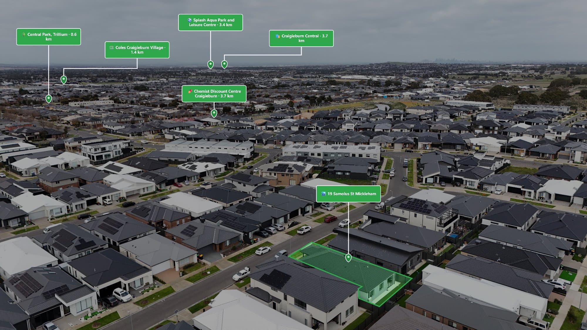
Canva is a powerful design tool, but it was not built for accurate drone image annotation. Learn why aerial photographers and real estate professionals are turning to specialised tools like AerialPin for smarter Point of Interest overlays.
Canva has become one of the most popular design platforms for creating marketing material, social media graphics and presentations. Its simple interface and large library of templates make it useful for many creative tasks.
However, when it comes to drone image annotation, Canva has limitations.
Adding labels to a drone photo is not just about placing text and arrows on an image. Professional aerial annotation requires understanding the location, camera angle, drone position and perspective of the image.
This is where specialised platforms like AerialPin provide a better workflow.
What Is Drone Image Annotation?
Drone image annotation is the process of adding useful information to aerial images.
For real estate marketing, this often includes:
- Schools
- Parks
- Shopping centres
- Train stations
- Beaches
- Restaurants
- Local landmarks
- Major roads
- Development areas
These annotations help buyers understand the location surrounding a property.
A drone photo shows what the property looks like from above. An annotated drone image explains why the location matters.
Why People Use Canva for Drone Images
Canva is popular because it makes graphic design accessible.
Many photographers use Canva to:
- Add text
- Create social media posts
- Design brochures
- Create property flyers
- Add simple graphics
For basic image design, Canva works extremely well.
The problem appears when accuracy becomes important.
The Problem With Manual Drone Annotation in Canva
When adding POI labels in Canva, the process is completely manual.
A typical workflow involves:
- Uploading the drone image
- Searching Google Maps for nearby locations
- Finding landmarks manually
- Estimating their position in the image
- Adding text boxes and icons
- Adjusting placement visually
- Exporting the final image
This approach relies heavily on guessing.
A location may appear close on a map but look completely different from the drone's perspective.
Canva Does Not Understand Drone Metadata
Modern drones capture valuable information inside each image file.
This can include:
- GPS coordinates
- Camera direction
- Altitude
- Lens information
- Camera angle
This information helps determine where locations should appear within the image.
Canva is designed as a graphic design platform. It does not analyse drone metadata or understand the relationship between camera position and real-world locations.
AerialPin is built specifically around this type of aerial image intelligence.
Accuracy Matters With Aerial Labels
A POI label only helps if it is accurate.
Imagine a property image showing:
- A school in the wrong direction
- A park incorrectly positioned
- A shopping centre placed too close
These mistakes can reduce trust with potential buyers.
Professional drone annotation requires more than simply placing a pin.
It requires understanding:
- Where the drone was located
- Which direction the camera was facing
- The camera field of view
- The angle of the image
- The relationship between the property and nearby locations
How AerialPin Improves Drone Annotation
AerialPin was designed specifically for aerial photographers, real estate professionals and property marketers.
Instead of manually creating every label, AerialPin helps automate the process.
The workflow is simple:
Upload Your Drone Image
Upload your aerial photo and let AerialPin analyse the image information.
Detect Nearby Points of Interest
AerialPin identifies relevant locations around the property, helping highlight the features that matter most to buyers.
Automatically Place Labels
Using aerial image positioning technology, AerialPin places points of interest directly onto the image.
Export Your Marketing Image
Create professional aerial marketing assets ready for:
- Real estate listings
- Social media
- Property brochures
- Builder presentations
- Development campaigns
Canva vs AerialPin for Drone Annotation
Canva
Best for:
- Social media graphics
- Marketing designs
- Flyers
- Presentations
- Basic image editing
Limitations:
- No drone metadata analysis
- No automatic location detection
- No camera positioning
- Manual label placement
- Time-consuming for multiple images
AerialPin
Built for:
- Drone photographers
- Real estate marketing
- Aerial image annotation
- Property location overlays
Features:
- GPS-based image analysis
- Automatic Point of Interest detection
- AI-powered placement
- Professional aerial exports
- Faster workflow
Why Real Estate Photographers Need Specialised Tools
Real estate photography is becoming more competitive.
Agents are looking for marketing material that does more than simply show a property.
Aerial images with location information help buyers understand:
- Lifestyle benefits
- Nearby amenities
- Accessibility
- Surrounding areas
Using specialised drone annotation software allows photographers to provide a higher-value service.
Save Hours on Every Property
Manually creating aerial annotations takes time.
For one image, it may only take a few minutes.
For dozens of listings every month, those minutes become hours.
AerialPin helps reduce repetitive editing by automating the process, allowing photographers to spend more time shooting and growing their business.
The Future of Aerial Marketing
Drone photography is evolving.
The next generation of aerial marketing is not just about capturing images from the sky. It is about adding meaningful information that helps people understand a location.
AI-powered tools are making it easier to create professional aerial content without spending hours on manual editing.
With AerialPin, photographers can move beyond basic image editing and create intelligent aerial marketing images that communicate the full story of a property.
Final Thoughts
Canva is an excellent design tool, but it was not created for accurate drone image annotation.
Adding professional POI labels requires more than text and graphics. It requires understanding the relationship between the drone, camera and real-world locations.
AerialPin helps photographers create accurate Point of Interest overlays automatically, making aerial images more informative, professional and valuable.
Whether you are a real estate photographer, drone operator, builder or property marketer, AerialPin gives you the tools to create better aerial marketing content faster.